
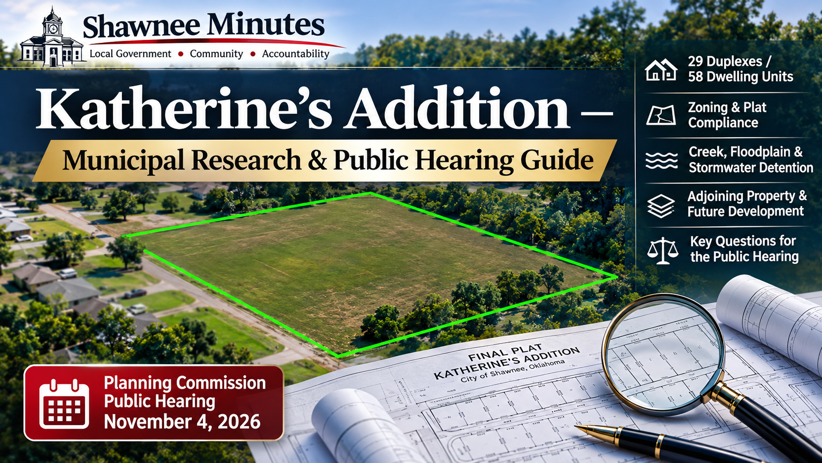
Katherine’s Addition: 58 Housing Units, One Platted Lot, and the Questions Shawnee Must Answer
An evidence-based examination of zoning, floodplain development, drainage, private infrastructure, adjoining land, and the public approval process at West 34th Street and North Beard Avenue.
Executive summary
Katherine’s Addition is proposed as a 4.696-acre, single-lot residential development containing 29 duplex buildings and 58 dwelling units. The developer’s materials also describe two private streets, a communal area/dog park, three phases, and a private sanitary sewer collection system with lift station. The City’s staff report states that duplexes are allowed by right in the R-1 district. That is not the same as a finding that every aspect of the proposed site design complies with the City’s standards.
The central accountability question is whether the public record contains adequate, written findings for the single-lot/multiple-building arrangement, actual building coverage, floodplain and drainage impacts, parking, emergency access, sewer ownership, and any potential future development on nearby Barrett Drilling property.
Project facts and numerical findings
| Subject | Finding | Significance |
|---|---|---|
| Project | Katherine’s Addition; PP01-26 / FP02-26 | Preliminary and final plat review |
| Applicant | Barrett Drilling Co. / John F. Barrett, as identified in agenda materials | Additional property ownership should be independently mapped |
| Area | 4.696 acres; approximately 204,557 sq. ft. | Gross parcel includes creek/drainage corridor per City correspondence |
| Proposed housing | 29 duplex buildings / 58 units | 12.35 units per gross acre |
| Coverage arithmetic | 40% × 4.696 = 1.8784 acres ≈ 81,823 sq. ft. | Maximum theoretical coverage, not certified buildable upland |
| Parking baseline | 58 × 1.5 = 87 spaces | Subject to applicable UDC provisions and authorized adjustments |
| Detention threshold | 4.696 acres vs. five acres | Conditional exemption requires scrutiny of runoff and off-site risk |
These calculations use the dimensions reported in the agenda materials. They are not substitutes for an approved site plan, measured building footprints, a traffic study, or a certified drainage model.
Chronology of documents and correspondence
| Date | Document / event | Research significance |
|---|---|---|
| July 27, 2026 | Applicant engineering transmittal | Describes a 4.696-acre single-lot development with 29 duplexes and 58 units |
| November 1, 2026 | Linda Agee questions maximum lot coverage | Asks whether creek acreage was removed from the calculation |
| November 2, 8:14 a.m. | Director Petya Stefanoff responds | Confirms R-1 40% coverage and inclusion of creek in gross parcel acreage |
| November 2, 9:44 a.m. | Director provides coverage arithmetic | 4.696 × 40% = 1.8784 acres; actual developable upland not determined by this arithmetic |
| November 2, 9:53 a.m. | Linda requests clarification | Asks whether creek/Zone AE are included and why private sewer/lift station is proposed |
| November 2, 11:38 a.m. | Director Stefanoff replies to Linda Agee | States that the development must comply with FEMA regulations and that a private lift station is needed to make the sewer system work and connect to the City utility; does not provide engineering calculations or permit details |
| November 4, 2026 | Planning Commission hearing in agenda packet | Opportunity to request findings and preserve questions in the public record |
| November 16, 2026 | Anticipated City Commission consideration | Verify agenda and current status before publication updates |
Publication status: This is a pre-decision case study as of November 2. It does not report a November 4 or November 16 outcome.
Density, permitted use, and neighborhood compatibility
The arithmetic is straightforward: 58 ÷ 4.696 = approximately 12.35 dwelling units per gross acre. Some general planning references call this medium density, but those generic thresholds do not automatically control Shawnee’s R-1 zoning classification. The staff report says duplex use is allowed by right under UDC § 22-197.
Residents may still ask how the City evaluated the proposed scale against adopted Comprehensive Plan policies, nearby homes, traffic, utility capacity, open space, and neighborhood access. Density and permitted use are different from site-plan compliance. An objection based solely on the label “low density” is weaker than a request for the actual adopted approval criteria and supporting findings.
Why the final plat does not show 29 individual duplex lot dimensions
The applicant’s engineering letter calls the proposal a single-lot residential development. That is the likely reason the final plat shows an overall legal tract rather than 29 individually dimensioned duplex parcels. Historic Engilman’s Addition lot labels visible on the drawing should not be mistaken for newly created duplex lots.
The unresolved issue is not simply whether 29 lot-width labels are absent. It is whether the City has a dimensioned master site plan showing each building footprint, setbacks, separation, parking, private roads, utilities and phase boundaries. A final plat and a site plan have different functions.
Creek, FEMA floodplain, and the meaning of 40% lot coverage
In her November 2 email, Community Development Director Petya Stefanoff stated that the creek remains inside the legal parcel boundaries and is included in the gross acreage used to calculate the R-1 maximum coverage. She later computed 4.696 acres × 40% = 1.8784 acres.
That answer clarifies the mathematical denominator. It does not identify how much upland is physically suitable for construction or the actual footprint of the 29 proposed buildings. The agenda packet identifies a drainage channel and FEMA Zone AE floodplain. A complete review should distinguish gross lot area, lot coverage, impervious area, and buildable upland.
- Obtain a surveyed floodplain and creek/easement overlay.
- Obtain the actual building-footprint and coverage worksheet.
- Ask whether any infill-palette or other exception is invoked and verify the controlling code text.
- Identify the exact location of building pads, yards, private streets and stormwater facilities.
Stormwater detention and the under-five-acre threshold
The City engineering review discusses a conditional detention exemption for residential development under five acres under Engineering Design Manual § 6.9.A(1). The proposed boundary is 4.696 acres, only 0.304 acre below five acres. The exemption is not a blanket exemption from drainage design, floodplain requirements or protection against aggravated downstream flood risk.
The essential engineering question is whether the City Engineer has documented the basis for the exemption and reviewed pre- and post-development runoff, downstream conditions, creek stability, outfall capacity and any coordinated future development. State construction-stormwater permitting rules and Shawnee’s local detention criteria are distinct regulatory systems.
Additional Barrett Drilling property and potential future phases
The attached Pottawatomie County assessor reports identify Barrett Drilling Co. as owner of Engilman’s Addition Block 2 Lots 1–10 and 27–36 and separately Block 1 Lots 1–9. Those descriptions amount to 20 and nine historic lots, respectively—not 29 additional proven building sites. The assessor acreage fields display 0.00; their land tables use lot units, not surveyed acreage.
The aerial images suggest nearby holdings, but without a GIS/title overlay it is not possible to prove which parcels directly adjoin the 4.696-acre boundary, which may overlap it, or how much additional acreage is available. A legitimate standalone phase, a future expansion, and possible attention to the detention threshold are competing explanations—not established findings.
- Map current ownership and recorded parcel boundaries against the proposed final plat.
- Request preapplication meeting notes, master plans and any future-phase concepts.
- Determine whether street, sewer or drainage facilities are sized for adjoining development.
- Ask whether cumulative runoff analysis is required if additional phases are pursued.
Parking, traffic, private streets, and emergency access
The earlier code review identified a baseline of 1.5 parking spaces per duplex dwelling unit, or 87 spaces for 58 units before authorized reductions. A scenario of 1.0–2.0 vehicles per dwelling would imply 58–116 vehicles, but vehicle ownership is not a substitute for a traffic-impact study.
Constituents should ask for a counted parking plan (including visitors, accessible and covered spaces), private-street cross sections, permitted on-street parking locations, sight-distance analysis, fire apparatus turning templates and a written Fire Marshal review. They should also request enforceable private-street maintenance responsibilities.
Private sanitary sewer and lift station
Follow-up questions raised by the City’s explanation
- What surveyed sewer invert elevations and hydraulic calculations establish the need for pumping rather than gravity service?
- Where will the private force main connect to the City's collection system, and has the receiving system's capacity been evaluated?
- Who will own, operate, inspect, power, maintain and replace the lift station, and what recorded agreement secures these obligations?
- What backup power, alarms, emergency storage and overflow protections are required?
- Which FEMA floodplain requirements apply to the proposed structures, fill, sewer infrastructure and drainage corridor, and what records document compliance?
The applicant’s materials describe a private sewer collection system and lift station. That does not by itself establish a defect. The public record should explain why this configuration was chosen, what connection alternatives were evaluated, and who is responsible for its lifetime operation.
- Engineering design, capacity and permits.
- Public sewer connection feasibility or alternatives analysis, if prepared.
- Backup power, alarm monitoring and emergency response arrangements.
- Recorded ownership, maintenance, reserve funding and replacement obligations.
- Responsibility if the development changes owners or phases expand.
Public notice, approval criteria, and legal options
Residents may submit written comments, speak under applicable meeting rules, request that relevant documents be entered into the record, and seek written findings on mandatory approval standards. They may ask for lawful deferral or disapproval where specific code requirements are unmet. The City’s authority may be constrained when a compliant plat is presented, so public opposition alone does not automatically justify denial.
Potential legal avenues include administrative challenges where authorized and judicial review or injunctive relief where a legally cognizable defect and required conditions exist. Filing deadlines and standing vary by the exact decision; an Oklahoma land-use attorney should review them promptly. A neighborhood petition is not automatically a binding veto of a final plat.
Constituents should also seek official proof of hearing notice and any corrections to earlier notice problems, rather than assume procedural invalidity.
What other Oklahoma development disputes can—and cannot—tell us
Earlier research referenced residential-development controversies in Tulsa, Midwest City, Ardmore and Oklahoma City, including reported rejection, approval and deferral outcomes. Those matters may illustrate how traffic, drainage, neighborhood fit and procedural standards affect local deliberations.
Comparison limitation: The earlier brief did not establish that these were legally identical final-plat proceedings or that the reported outcomes were confirmed against complete official minutes. They should not be presented as binding precedent or as proof Shawnee must reach the same result. Before publication of named case details, verify each municipality’s agenda, case number, hearing date and final disposition.
20 questions for the November 4 Planning Commission
These questions are organized so multiple speakers can cover distinct issues. Ask the chair about speaking limits and submit the full set in writing.
What precise UDC provision permits 29 duplex buildings on one R-1 legal lot, and is that interpretation documented?
Will the development remain one lot, or are future lot splits or condominium arrangements anticipated?
Where is the dimensioned site plan showing each building footprint, separation, setbacks and phase boundaries?
What is the actual lot-coverage percentage and where is the worksheet for all proposed building footprints?
How much of the 4.696 acres falls within the creek corridor, drainage easements and FEMA Zone AE, and what is the independently determined buildable upland?
Is any infill-palette coverage exception, waiver or variance being requested or used?
Which adopted Comprehensive Plan provisions support 58 dwellings at 12.35 gross units per acre?
How many resident, visitor, accessible and covered spaces are required and provided?
Are any reductions or on-street credits proposed, and how will emergency access remain unobstructed?
What peak-hour trip, sight-distance and street-capacity analyses have been completed for 34th and Beard?
What widths, turning radii, parking restrictions and long-term maintenance provisions govern Pearl and Saadat Streets?
What written Fire Marshal review confirms fire access, hydrants and fire-flow adequacy?
Where are the final pre- and post-development runoff calculations, outfall maps and creek stabilization plans?
What written City Engineer determination supports the under-five-acre detention exemption, including downstream flood-risk findings?
What records explain why the application boundary is 4.696 acres, 0.304 acre below five acres?
Which Barrett-owned parcels directly adjoin or overlap the project, and have future phases been discussed?
Has the City assessed a possible common development plan and cumulative drainage, traffic and utility effects?
Why is a private sewer and lift station proposed, and who pays for backup power, maintenance and replacement?
Were any hearing-notice defects identified, and what records demonstrate correction and compliance?
What mandatory criteria govern final plat approval, and what can the Commission lawfully defer or disapprove if evidence is missing?
Open Records Act priorities and evidence checklist
A formal Oklahoma Open Records Act request has been prepared separately. Its strongest categories are:
- All application versions, plat drawings, staff review comments, approvals and written zoning interpretations.
- The dimensioned site plan and building-footprint/lot-coverage calculations.
- Survey/GIS overlays for the creek, FEMA Zone AE, drainage easements and buildable upland.
- Drainage models, exemption findings, downstream risk analysis and creek stabilization plans.
- Parking, traffic, street cross sections, Fire Marshal review and emergency-access drawings.
- Private sewer/lift-station designs, alternatives, agreements and maintenance obligations.
- Boundary-selection records, preapplication correspondence and future-phase or common-plan materials for adjoining property.
- Hearing notices, minutes, recordings, public submissions and final written findings.
Request existing electronic records in native formats when available, rolling production, an itemized fee estimate, and the statutory basis for any withholding. The records custodian need not create a new study to answer a research question.
Constituent participation: recommended next steps
- Before the hearing: Submit concise written objections tied to specific code sections and attach the full 20-question list; request inclusion in the official record.
- At the hearing: Divide questions among speakers, focus on unresolved documentary findings, and ask for a written response to each material compliance issue.
- After the hearing: Obtain minutes, votes, conditions and staff responses. Update the case study with verified outcomes and distinguish new evidence from prior allegations.
- Before any final action: Seek legal review of any documented code defect, available administrative remedies and time-sensitive judicial deadlines.
- For future phases: Monitor new applications affecting adjoining parcels and request cumulative drainage/utility review where applicable.
Source register, methodology, limitations and update log
Primary materials
- City of Shawnee Planning Commission agenda packet, November 4, 2026: project staff report and engineering/plat materials, especially pp. 5–10 and 20–30.
- Applicant engineering transmittal, July 27, 2026: single-lot development description, 29 duplex buildings and 58 units (agenda packet p. 24).
- Linda Agee–Petya Stefanoff correspondence, November 1–2, 2026: creek included in gross acreage; 40% calculation; follow-up questions about floodplain and private sewer.
- Pottawatomie County assessor extracts: four pages of property reports and aerial highlights identifying Barrett Drilling Co. and historic Engilman’s Addition lots.
- Shawnee Unified Development Code: provisions discussed in prior research include §§ 22-197, 22-208(C), 22-228 and 22-229; verify the version effective on the decision date.
- Shawnee Engineering Design Manual: § 6.9.A(1), as referenced in the engineering review, concerning the conditional detention exemption.
- Consolidated research report: Katherine’s Addition Comprehensive Municipal Research, Engineering Questions, Legal Options & Public Participation Guide, November 2, 2026, with assessor and records-request exhibits.
Evidence classification
Documented: submitted project description, City email arithmetic, assessor owner/lot descriptions. Calculated: density, theoretical coverage, threshold difference and parking baseline. Unresolved: actual buildable upland, footprint compliance, adjoining parcel acreage, future phases, developer intent and final approval outcome.
Update log
November 2, 2026: Initial consolidated case study prepared. November 2, 11:38 a.m. CST: Added Director Stefanoff's FEMA-compliance and private-lift-station response, together with targeted engineering, utility and floodplain follow-up questions. No later Commission action or developer response is represented as known.
Editorial fairness: This case study reflects concerns raised by residents, including opposition to the proposal. The applicant and City should have the opportunity to provide clarifying records or responses. Claims of improper motive, illegality or engineering failure should not be stated as established without corroborating evidence.
Disclaimer: Independent public-interest research and commentary; not a legal opinion, engineering certification or finding of misconduct. Readers should consult the controlling municipal code, official records and qualified professionals before relying on a claim for litigation or permitting.